Alto Caparaó, Minas Gerais
Gateway to the Pico da Bandeira · Serra do Caparaó
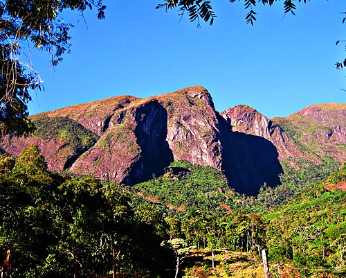
Alto Caparaó is the Minas Gerais gateway to the Parque Nacional do Caparaó, home to the Pico da Bandeira, the highest point in Minas Gerais, at 2,891 m. The municipality was established in 1997. The highland climate and the trails draw mountaineers all year round. The settlement was formed by descendants of Germans.
Alto Caparaó at a glance
- Population: 5,8 thousand
- Area: 104 km²
- Elevation: 959 m
- Distance from Belo Horizonte: 322 km
- Demonym: alto-caparoense
- Founded: 1997
- Region: Zona da Mata and Vertentes
- Tourism region: IGR Pico da Bandeira
- Area code: 32
- IBGE code: 3102050
Alto Caparaó is part of the tourism region IGR Pico da Bandeira.
History
The settlement arose around 1900, formed by descendants of Germans. In 1928, Francisco Valério acquired land in the region, which attracted large cattle ranchers.
The Parque Nacional do Caparaó was created on May 24, 1961, at the proposal of Inimá Novais de Campos. In 1967, the Guerrilha do Caparaó, one of the first armed movements against the military regime, was broken up in the region.
Caparaó Velho, a district of Carangola, was renamed Alto Caparaó by law 8,285 of 1982. After a referendum in 1995 and elections in 1996, the municipality was established on January 1, 1997.
Timeline
- c. 1900 · The settlement arises, formed by descendants of Germans
- 1928 · Francisco Valério acquires land in the region
- 1961 · The Parque Nacional do Caparaó is created
- 1967 · The Guerrilha do Caparaó is broken up
- 1982 · Caparaó Velho is renamed Alto Caparaó
- 1995 · Independence referendum
- 1997 · The municipality is established on January 1
Things to do in Alto Caparaó: attractions
Parque Nacional do Caparaó
Nature · Alto Caparaó
Created in 1961, it is home to the Pico da Bandeira, the Pico do Cristal and preserved valleys. It is one of the most visited parks in the country.
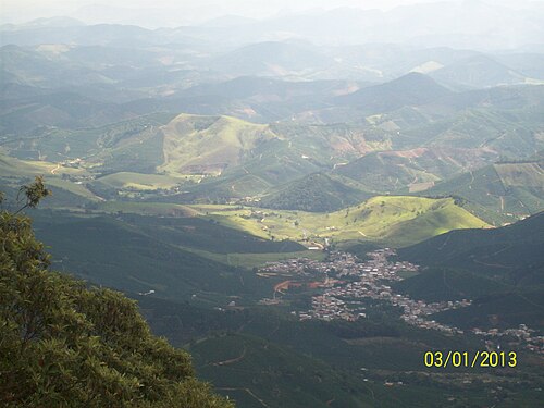
Pico da Bandeira
Viewpoint · Parque Nacional do Caparaó
At 2,891 m, it is the highest point in Minas Gerais and the third highest in Brazil. It sits on the border with Espírito Santo.
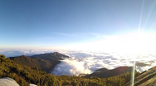
Cachoeira Bonita
Waterfall · Parque Nacional do Caparaó
A drop of about 80 m inside the park.
Vale Verde
Nature · Parque Nacional do Caparaó
A valley in the park, with trails and camping areas.
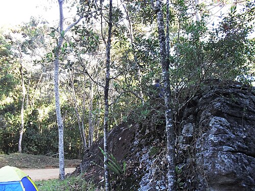
Vale Encantado
Nature · Parque Nacional do Caparaó
A valley in the park, with highland scenery.
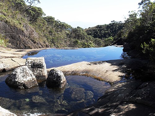
Igreja Matriz de Nossa Senhora da Conceição
Church · Centro, Alto Caparaó
Built in 1890.
Face de Cristo
Nature · Alto Caparaó
A rock formation that resembles a face.
Heritage
- Parque Nacional do Caparaó · A federal protected area, created in 1961
- Igreja Matriz de Nossa Senhora da Conceição · A church from 1890
Nature
- Serra do Caparaó · The second-highest mountain range in Brazil, after the Serra do Imeri
- Pico do Cristal · 2,769 m
Rivers and waters
- River basin: Itabapoana river basin
- Rivers: Rio Caparaó, Rio José Pedro
- Springs: The Caparaó and José Pedro rivers rise inside Caparaó National Park.
Climate
- Type: Tropical highland, with an annual average between 19 °C and 22 °C
- Winter: Cold, with frost in the mountains; July is the coldest month
- Summer: February is the warmest month; rain from November to January
- Best time to visit: April to September, the driest season
Typical food
- Specialty coffee (café especial) · The region's high-altitude plantations produce award-winning coffees. Fazenda Ninho da Águia won Coffee of the Year in 2014.
Festivals and events
- Corn Festival (Festa do Milho) (Abr) · Festival on the Praça da Matriz with country viola music, corn dishes and the tombo da polenta (polenta turnout), tied to the Italian heritage.
- Coffee Festival (Festival do Café) (Set) · Recent event celebrating local coffee, with a quality contest.
Fun facts
- The Pico da Bandeira is the 3rd highest peak in Brazil.
- The municipality grew out of the former district of Caparaó Velho.
- In 2010, 55.9% of the population was evangelical Protestant, mostly Presbyterian.
Getting there
- Belo Horizonte · About 330 km by road
- Vitória · About 225 km by road
- Rio de Janeiro · About 430 km by road
Notable people from Alto Caparaó
- Inimá Novais de Campos · Proposed the creation of the National Park and carried out urban improvements
- Francisco Valério · The first to acquire land in the region, in 1928
City hall
- Mayor: Sebastião Ananias Campos (PSD), term 2025–2028
- Address: Rua Ludovina Emerick, 321, Água Verde, Alto Caparaó, MG, CEP 36979-000
- Phone: (32) 98451-8086
- Opening hours: Monday to Friday, 12:00 to 18:00
- Website: altocaparao.mg.gov.br
Frequently asked questions
Where is Alto Caparaó?
Alto Caparaó is a municipality in the state of Minas Gerais, Brazil, in the Zona da Mata and Vertentes region, 322 km from Belo Horizonte.
What is there to do in Alto Caparaó?
The attractions of Alto Caparaó include Parque Nacional do Caparaó, Pico da Bandeira, Cachoeira Bonita, Vale Verde, Vale Encantado, Igreja Matriz de Nossa Senhora da Conceição.
What is the population of Alto Caparaó?
Alto Caparaó has about 5,8 thousand inhabitants in an area of 104 km².
What is the typical food of Alto Caparaó?
Specialty coffee (café especial) (The region's high-altitude plantations produce award-winning coffees. Fazenda Ninho da Águia won Coffee of the Year in 2014).
When is the best time to visit Alto Caparaó?
April to September, the driest season. The climate is tropical highland, with an annual average between 19 °c and 22 °c.
How do you get to Alto Caparaó?
Belo Horizonte: About 330 km by road. Vitória: About 225 km by road. Rio de Janeiro: About 430 km by road.
Who was born in Alto Caparaó?
Notable people from Alto Caparaó include Inimá Novais de Campos, Francisco Valério.
Which tourism region is Alto Caparaó part of?
Alto Caparaó is part of IGR Pico da Bandeira, one of the 47 official tourism regions of Minas Gerais, with 23 municipalities.
What are the festivals of Alto Caparaó?
Corn Festival (Festa do Milho) (Abr), Coffee Festival (Festival do Café) (Set).
What are people from Alto Caparaó called?
People born in Alto Caparaó are called alto-caparoense.
Towns near Alto Caparaó
- Alto Jequitibá · 10 km in a straight line
- Caparaó · 11 km in a straight line
- Manhumirim · 12 km in a straight line
- Martins Soares · 20 km in a straight line
- Luisburgo · 23 km in a straight line
- Reduto · 24 km in a straight line
- Espera Feliz · 25 km in a straight line
- Manhuaçu · 25 km in a straight line