Frutal, Minas Gerais
Land of pineapple · Triângulo Mineiro, on the banks of the Rio Grande
Frutal is in the Triângulo Mineiro, on the border with São Paulo, and is one of the largest pineapple producers in Minas. The town grew up around the chapel of Nossa Senhora do Carmo, on a route between São Paulo and Goiás. Today it has strong agriculture and livestock farming, sugarcane, grains and an education hub. Part of its territory borders the Marimbondo reservoir, on the Rio Grande.
Frutal at a glance
- Population: 58,6 thousand
- Area: 2.427 km²
- Elevation: 485 m
- Distance from Belo Horizonte: 600 km
- Demonym: frutalense
- Founded: 1888
- Region: Triângulo and Alto Paranaíba
- Tourism region: IGR Rota do Triângulo
- Area code: 34
- IBGE code: 3127107
Frutal is part of the tourism region IGR Rota do Triângulo.
History
The settlement grew up around the chapel of Nossa Senhora do Carmo, built by Antônio de Paula e Silva, on a route linking São Paulo to Goiás and Mato Grosso. It became an arraial (village) in 1850 and was incorporated into Uberaba in 1854. In 1858 it was made a distrito de paz (district with a justice of the peace).
The Vila de Nossa Senhora do Carmo de Frutal was separated from Uberaba by Provincial Law No. 3,325 of October 5, 1885, and the municipality was established on October 25, 1888. Its status as a city was reaffirmed by State Law No. 23 of May 24, 1892.
Over the 20th century its territory shrank with the creation of new municipalities: São Francisco de Sales (1938), Comendador Gomes and Itapagipe (1948), and Planura (1962).
Timeline
- 1850 · The settlement becomes an arraial (village)
- 1854 · Incorporated into Uberaba
- 1858 · Made a distrito de paz
- 1885 · Creation of the Vila de Nossa Senhora do Carmo de Frutal
- 1888 · Establishment of the municipality
- 1892 · State Law No. 23 reaffirms its city status
- 1938 · Loses territory to São Francisco de Sales
- 1962 · Creation of Planura, from Frutal's territory
Things to do in Frutal: attractions
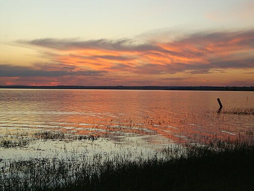
Reservatório de Marimbondo
Nature · Grande River, border with São Paulo
A reservoir on the Rio Grande that reaches Frutal, Fronteira and Planura. Used for fishing and leisure.
Rio Grande
Nature
Marks the border between Minas and São Paulo in the Frutal area.
Praça Dr. França
Square · Praça Dr. França, Centro
Central square where the city hall is located.
Heritage
- Antigo Paço Municipal · A 1924 building that housed the courthouse, town hall and council. It is a listed building and has hosted the Casa da Cultura since 2005.
Nature
- Reservatório de Marimbondo · A lake formed on the Rio Grande, spreading across Frutal, Fronteira and Planura.
Rivers and waters
- River basin: Grande River Basin
- Rivers: Rio Grande, Ribeirão Frutal
Climate
- Type: Tropical
- Winter: Dry, with a record low of −1 °C (July 1942)
- Summer: Hot and rainy, with a record high of 41.3 °C (October 2012)
Typical food
- Pineapple · Pineapple, the fruit that made the town's farming famous.
Festivals and events
- Frutal Rodeo Music (Out) · Festival with rodeo and concerts celebrating the town's anniversary.
Fun facts
- The town's name recalls the local streams, once full of jabuticaba trees.
- The fish species Trichomycterus coelhorum, discovered in the region, honors the Coelho family of Frutal.
- Frutal is one of the education hubs of the Triângulo Mineiro.
Getting there
- Belo Horizonte · 600 km via BR-381, BR-262, MGC-455 and LMG-733
- Uberaba · About 145 km
- Uberlândia · About 186 km
- Ribeirão Preto (SP) · 197 km via SP-322, SP-310 and BR-364
- São Paulo (SP) · 515 km via the Bandeirantes, Washington Luiz and BR-364
Districts
Notable people from Frutal
- Nárcio Rodrigues · Politician born in Frutal in 1959, he was a federal deputy for Minas Gerais.
- Oplonizia Alves de Oliveira · Writer and composer of the song Eu te saúdo Frutal, from 1975.
People born in Frutal
- Camila Brait · Brazilian volleyball player
- Jamba · Businessman, music producer, artist, composer, multi-instrumentalist, photographer, film director
- Jose Roberto Domingos da Costa · Político do Brasil · b. 1967
- Leonel Paiva · Brazilian politician
- Nino Piantamar · Músico brasileiro · b. 1990
- Onevan de Matos · Brazilian politician · 1942–2020
- Ronaldo Dimas · Político brasileiro · b. 1961
- Solimar Dias Duarte · Futebolista brasileiro · b. 1975
- Yara Lins · Brazilian actress · 1930–2004
City hall
- Mayor: Bruno Augusto de Jesus Ferreira (Republicanos), term 2025–2028
- Address: Praça Dr. França, 100, Centro, Frutal, MG
- Website: www.frutal.mg.gov.br
Frequently asked questions
Where is Frutal?
Frutal is a municipality in the state of Minas Gerais, Brazil, in the Triângulo and Alto Paranaíba region, 600 km from Belo Horizonte.
What is there to do in Frutal?
The attractions of Frutal include Reservatório de Marimbondo, Rio Grande, Praça Dr. França.
What is the population of Frutal?
Frutal has about 58,6 thousand inhabitants in an area of 2.427 km².
What is the typical food of Frutal?
Abacaxi (Pineapple, the fruit that made the town's farming famous).
How do you get to Frutal?
Belo Horizonte: 600 km via BR-381, BR-262, MGC-455 and LMG-733. Uberaba: About 145 km. Uberlândia: About 186 km. Ribeirão Preto (SP): 197 km via SP-322, SP-310 and BR-364. São Paulo (SP): 515 km via the Bandeirantes, Washington Luiz and BR-364.
Who was born in Frutal?
Notable people from Frutal include Nárcio Rodrigues, Oplonizia Alves de Oliveira, Camila Brait (brazilian volleyball player), Jamba (businessman, music producer, artist, composer, multi-instrumentalist, photographer, film director), Jose Roberto Domingos da Costa (politician of brazil), Leonel Paiva (brazilian politician), Nino Piantamar (brazilian musician), Onevan de Matos (brazilian politician).
Which tourism region is Frutal part of?
Frutal is part of IGR Rota do Triângulo, one of the 47 official tourism regions of Minas Gerais, with 30 municipalities.
What are the festivals of Frutal?
Frutal Rodeo Music (Out).
What are people from Frutal called?
People born in Frutal are called frutalense.
Towns near Frutal
- Planura · 28 km in a straight line
- Pirajuba · 28 km in a straight line
- Fronteira · 39 km in a straight line
- Comendador Gomes · 39 km in a straight line
- Campo Florido · 48 km in a straight line
- Itapagipe · 48 km in a straight line
- Conceição das Alagoas · 59 km in a straight line
- Veríssimo · 77 km in a straight line