Itamarandiba, Minas Gerais
Water tower of the Vale do Jequitinhonha · Serra Negra and eucalyptus groves
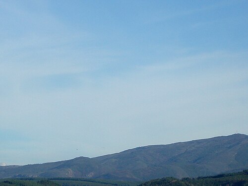
Itamarandiba lies in the Alto Jequitinhonha and is known as the water tower of the Vale, because it holds the springs of rivers that flow into the Jequitinhonha and Doce basins. It is home to the Parque Estadual da Serra Negra, in the Serra do Espinhaço. The economy combines eucalyptus, seedling production, charcoal, cattle ranching and family farming. The municipality has the largest cattle herd in the Alto Jequitinhonha.
Itamarandiba at a glance
- Population: 33 thousand
- Area: 2.740 km²
- Elevation: 950 m
- Distance from Belo Horizonte: 406 km
- Demonym: itamarandibano
- Founded: 1862
- Region: North and Northwest
- Tourism region: IGR Pedras Preciosas
- Area code: 38
- IBGE code: 3132503
Itamarandiba is part of the tourism region IGR Pedras Preciosas.
History
Settlement of the region dates back to the 17th century and is linked to the expansion of the bandeirante (colonial explorer) Fernão Dias Paes. The village was called São João Batista.
The place became a district in 1840 and a municipality in 1862. There are prehistoric inscriptions at the Sítio Arqueológico de Campos das Flores, in the district of Penha de França.
In 1974, Acesita bought the old Pavie family farm and planted eucalyptus, which shaped the local economy in the decades that followed.
Timeline
- 17th c. · Start of settlement linked to the expansion of Fernão Dias Paes
- 1840 · Becomes a district
- 1862 · The municipality gains autonomy
- 1974 · Acesita buys the Pavie farm and plants eucalyptus
- 1998 · Creation of the Parque Estadual da Serra Negra
Things to do in Itamarandiba: attractions
Parque Estadual da Serra Negra
Nature · About 33 km from the town seat
Protected area of about 13,600 hectares in the Serra do Espinhaço, with waterfalls, caves and lookouts. Visits must be arranged with the park administration.
Igreja de Nossa Senhora do Rosário
Church · Town center
Church tied to the traditional Festa de Nossa Senhora do Rosário dos Homens Pretos.
Igreja de Nossa Senhora da Penha
Church · Penha de França
Historic church in the district of Penha de França.
Sítio Arqueológico de Campos das Flores
Nature · Penha de França
Site with prehistoric inscriptions, in the district of Penha de França.
Praça dos Agricultores
Square · Praça dos Agricultores, Centro
The town's central square, where City Hall stands.
Municipal Market
Market · Town center
Hub for local trade and regional products.
Colonial manor houses in the center
Square · Town center
A group of old mansions that recall the town's past.
Heritage
- Parque Estadual da Serra Negra · Protected area created in 1998, with the springs of rivers in the Jequitinhonha and Doce basins.
- Sítio Arqueológico de Campos das Flores · Prehistoric inscriptions in the district of Penha de França.
Nature
- Serra Negra · Part of the Serra do Espinhaço, with a high point of 1,581 m, canelas-de-ema (tree lilies), orchids and maned wolves.
- Mata Atlântica e Cerrado · Biomes found in the municipality.
Rivers and waters
- River basin: Jequitinhonha river basin (part of the area in the Rio Doce basin)
- Rivers: Rio Araçuaí, Rio Itamarandiba, Rio São João, Rio Itacarambi, Ribeirão Santo Antônio
- Springs: The Serra Negra shelters springs that feed the Jequitinhonha and Araçuaí rivers and tributaries of the Rio Doce.
Climate
- Type: Highland tropical
- Winter: Cold nights, with a recorded low of 3.1 °C in May 2022
- Summer: Hot and rainy, with a high of 38 °C in November 2023
Typical food
- Pork ribs with angu · Pork ribs with cornmeal mush, a common local dish with colonial roots.
- Canjiquinha · Served at many spots around town.
- Dishes with pequi · The cerrado fruit is present in the town's cooking.
Festivals and events
- Expoita · The municipality's agricultural and livestock fair
- Feast of Nossa Senhora do Rosário dos Homens Pretos · Traditional religious festival
- Semana Santa e Corpus Christi · Religious celebrations
Fun facts
- It is called the water tower of the Vale do Jequitinhonha.
- The name is of Tupi origin.
- It is one of the state's largest producers of eucalyptus seedlings, with more than 30 million a year.
Getting there
- Belo Horizonte · About 380 km
Districts
- Contrato
- Dom Serafim
- Padre João Afonso
- Penha de França
- Santa Joana
- Santa Luzia de Minas
- Várzea de Santo Antônio
Notable people from Itamarandiba
- Fernão Dias Paes · Bandeirante linked to the settlement of the region
- Fernando Brant · Lyricist who wrote a song about the town, a partner of Milton Nascimento
- Lithielen Milenn · Miss Congeniality 2014, linked to the town
People born in Itamarandiba
- Délio de Jesus Malheiros · Político do Brasil · b. 1961
- Francisco Santos Gandra · Político brasileiro · b. 1953
- Geraldo Vieira Gusmão · Padre católico, bispo católico, teólogo · b. 1934
- Isabelly Morais · Brazilian sports journalist
- Jose Adair de Sousa · Político do Brasil · b. 1956
- José André Coimbra
- João Gomes · Político do Brasil · b. 1958
- Marquinho Durval · Brazilian politician
- Takão · n. 1946
- Vicente Fernandes Guabiroba · Brazilian politician · 1922–2011
City hall
- Mayor: Pedro Afonso (Avante), term 2025–2028
- Address: Praça dos Agricultores, 25, Centro, Itamarandiba, MG, CEP 39668-018
- Phone: 0800 042 0974
- Opening hours: Monday to Friday, 7:30 to 17:00
- Website: itamarandiba.mg.gov.br/site
Frequently asked questions
Where is Itamarandiba?
Itamarandiba is a municipality in the state of Minas Gerais, Brazil, in the North and Northwest region, 406 km from Belo Horizonte.
What is there to do in Itamarandiba?
The attractions of Itamarandiba include Parque Estadual da Serra Negra, Igreja de Nossa Senhora do Rosário, Igreja de Nossa Senhora da Penha, Sítio Arqueológico de Campos das Flores, Praça dos Agricultores, Mercado Municipal.
What is the population of Itamarandiba?
Itamarandiba has about 33 thousand inhabitants in an area of 2.740 km².
What is the typical food of Itamarandiba?
Costelinha de porco com angu (Pork ribs with cornmeal mush, a common local dish with colonial roots); Canjiquinha (Served at many spots around town); Dishes with pequi (The cerrado fruit is present in the town's cooking).
How do you get to Itamarandiba?
Belo Horizonte: About 380 km.
Who was born in Itamarandiba?
Notable people from Itamarandiba include Fernão Dias Paes, Fernando Brant, Lithielen Milenn, Délio de Jesus Malheiros (politician of brazil), Francisco Santos Gandra (brazilian politician), Geraldo Vieira Gusmão (catholic priest, catholic bishop, theologian), Isabelly Morais (brazilian sports journalist), Jose Adair de Sousa (politician of brazil).
Which tourism region is Itamarandiba part of?
Itamarandiba is part of IGR Pedras Preciosas, one of the 47 official tourism regions of Minas Gerais, with 35 municipalities.
What are the festivals of Itamarandiba?
Expoita, Festa de Nossa Senhora do Rosário dos Homens Pretos, Semana Santa e Corpus Christi.
What are people from Itamarandiba called?
People born in Itamarandiba are called itamarandibano.
Towns near Itamarandiba
- Aricanduva · 32 km in a straight line
- Frei Lagonegro · 37 km in a straight line
- Senador Modestino Gonçalves · 40 km in a straight line
- São Sebastião do Maranhão · 40 km in a straight line
- Carbonita · 40 km in a straight line
- Capelinha · 41 km in a straight line
- Coluna · 42 km in a straight line
- Felício dos Santos · 48 km in a straight line