Capitólio, Minas Gerais
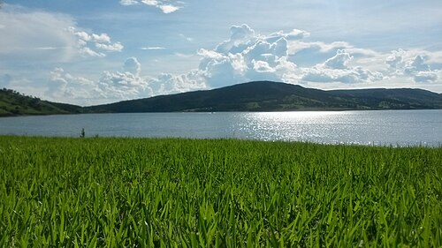
Lago de Furnas · Southwestern Minas
Surrounded by quartzite canyons and the green waters of Lago de Furnas, Capitólio has become one of the most sought-after nature destinations in Minas. Speedboat rides, waterfalls, and viewpoints keep the town busy all year round.
Capitólio at a glance
- Population: 9 thousand
- Area: 522 km²
- Elevation: 750 m
- Distance from Belo Horizonte: 280 km
- Demonym: to be confirmed
- Founded: to be confirmed
- Region: Center-West
- Tourism region: IGR Nascentes das Gerais e Canastra
- Area code: 37
- IBGE code: 3112802
Capitólio is part of the tourism region IGR Nascentes das Gerais e Canastra.
History
The region, once called Mata do Rio Piumhi, was settled by Portuguese explorers during the gold era. Around 1830, the brothers João, Manoel, and Antônio Francisco settled there, and the village became known as Arraial dos Franciscos. It was later called Arraial dos Cabeças.
Between 1895 and 1900, the chapel of São Sebastião was built, and the place came to be called Arraial de São Sebastião dos Franciscos. In 1923, a state law detached the village from Piumhi and annexed it to Guapé. A territorial dispute thwarted the first request for emancipation, in 1943.
The municipality of Capitólio was created by State Law 336 of December 27, 1948, signed by Governor Milton Campos.
The construction of the Furnas Dam on the Rio Grande formed a large lake that flooded part of the territory and created the canyons that attract tourists today. The town traded its rural economy for nature tourism and became known as the sea of Minas.
Timeline
- 19th c. · Cattle ranches occupy the Rio Grande region.
- 1963 · The filling of the Furnas reservoir forms the lake and changes the landscape.
- 2000s · Boat and waterfall tourism grows and becomes the main activity.
Things to do in Capitólio: attractions
Furnas Canyons
Nature · Furnas Lake, departures from the Rio Turvo Bridge
Rock walls bathed by the green waters of Lago de Furnas. They are visited on speedboat tours.
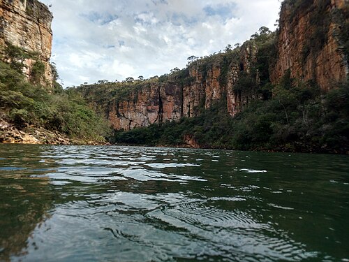
Canyons Lookout
Viewpoint · MG-050, km 312, toward São João Batista do Glória
Park with a view from above the canyons, a 110 m suspension bridge, a zip line, and trails.
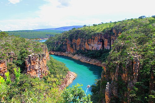
Lagoa Azul
Nature · Alongside MG-050, about 28 km from the center
A very clear water pool just a few meters from Lago de Furnas. It can be visited by speedboat or on a short trail.
Cachoeiras Diquadinha
Waterfall · MG-050, opposite the access to the Furnas Canyon viewpoint
Three falls in a row, with clear-water pools and orange-tinted bottoms.
Complexo Trilha do Sol
Waterfall · MG-050, 1 km before the Rio Turvo Bridge, about 23 km from the center
A group of waterfalls, small canyons, and natural pools, such as Cachoeira do Grito and Poço Dourado.
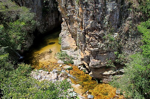
Morro do Chapéu
Viewpoint · Dirt road, about 12 km from the center
Viewpoint at 1,293 m of altitude, with a chapel and views of Lago de Furnas and the Serra da Canastra. Admission is free.
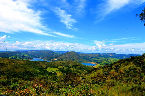
Vale dos Tucanos
Nature · Lago de Furnas
A classic stop on speedboat tours of the lake, with rock walls and cascades.
Lago de Furnas
Lake · Rio Turvo Bridge, about 15 km from the center
Reservoir formed by the Furnas Dam, popular for boat rides, swimming, and sport fishing.
Heritage
- Furnas Canyons · Rock walls navigable by speedboat.
- Canyons Lookout · View from above the rock walls.
- Cachoeira Lagoa Azul · Blue-water pool surrounded by forest.
Nature
- Furnas Canyons · Speedboat tour of 1 to 2 hours.
- Trilha do Sol · A series of pools and waterfalls.
Rivers and waters
- River basin: Rio Grande
- Rivers: Rio Grande (Lago de Furnas), Córregos da serra
- Springs: Several waterfalls spring from the cliffs that drop down to the lake.
Climate
- Type: Tropical
- Winter: Dry and sunny
- Summer: Hot and rainy
- Best time to visit: April to October
Typical food
- Freshwater fish · Tilapia and peacock bass grilled over embers.
- Canastra Cheese · From the neighboring Serra da Canastra region.
Festivals and events
- New Year's Eve on the lake (Dec) · Shows and fireworks.
- Carnival (Feb) · Parties on the lakeshore and on boats.
Fun facts
- Lago de Furnas is called the sea of Minas.
Getting there
- Belo Horizonte · 280 km via MG-050, about 4 hours
- Passos · 70 km
Notable people from Capitólio
- Boatmen and guides · Local professionals who take visitors to the canyons.
People born in Capitólio
- Jamilton Pereira dos Santos · Político do Brasil · b. 1947
City hall
- Mayor: Jaime Leonel Sobrinho (Novo), term 2025–2028
- Address: Rua Monsenhor Mário da Silveira, 110, Centro, Capitólio (MG), CEP 37930-000
- Phone: (37) 3373-0300
- Opening hours: Monday to Friday, 8:00 to 11:00 and 12:30 to 17:00
- Website: www.capitolio.mg.gov.br
Frequently asked questions
Where is Capitólio?
Capitólio is a municipality in the state of Minas Gerais, Brazil, in the Center-West region, 280 km from Belo Horizonte.
What is there to do in Capitólio?
The attractions of Capitólio include Cânions de Furnas, Mirante dos Cânions, Lagoa Azul, Cachoeiras Diquadinha, Complexo Trilha do Sol, Morro do Chapéu.
What is the population of Capitólio?
Capitólio has about 9 thousand inhabitants in an area of 522 km².
What is the typical food of Capitólio?
Freshwater fish (Tilapia and peacock bass grilled over embers); Queijo Canastra (From the neighboring Serra da Canastra region).
When is the best time to visit Capitólio?
April to October. The climate is tropical.
How do you get to Capitólio?
Belo Horizonte: 280 km via MG-050, about 4 hours. Passos: 70 km.
Who was born in Capitólio?
Notable people from Capitólio include Barqueiros e guias, Jamilton Pereira dos Santos (politician of brazil).
Which tourism region is Capitólio part of?
Capitólio is part of IGR Nascentes das Gerais e Canastra, one of the 47 official tourism regions of Minas Gerais, with 20 municipalities.
What are the festivals of Capitólio?
Réveillon no lago (Dec), Carnaval (Feb).
What are people from Capitólio called?
People born in Capitólio are called a confirmar.
Towns near Capitólio
- Piumhi · 18 km in a straight line
- Guapé · 21 km in a straight line
- Pimenta · 29 km in a straight line
- São José da Barra · 30 km in a straight line
- Doresópolis · 40 km in a straight line
- Carmo do Rio Claro · 40 km in a straight line
- Ilicínea · 43 km in a straight line
- Alpinópolis · 45 km in a straight line