Itamonte, Minas Gerais
Capital of Queijo Mantiqueira de Minas · Serra da Mantiqueira
Itamonte sits high in the Serra da Mantiqueira, in the Sul de Minas region. It is a gateway to the Parque Nacional do Itatiaia and to famous trails such as the Serra Fina. It has the 2,151 m Pedra do Picu and several waterfalls. High-altitude dairy farming is the backbone of the economy and gives fame to the Queijo Mantiqueira de Minas (a regional artisanal cheese).
Itamonte at a glance
- Population: 14,8 thousand
- Area: 431,8 km²
- Elevation: 900 m
- Distance from Belo Horizonte: 417 km
- Demonym: itamontense
- Founded: 1938
- Region: Southern Minas
- Tourism region: IGR Terras Altas da Mantiqueira
- Area code: 35
- IBGE code: 3133006
Itamonte is part of the tourism region IGR Terras Altas da Mantiqueira.
History
The region was a route for expeditions that climbed the Serra da Mantiqueira in search of Indigenous people, gems and minerals. A rest stop at the foot of the mountains, the Pouso do Pico, served as a landmark for the bandeirantes (colonial explorers). Over time, the name Pico became Picu.
In 1870, a provincial law created the district of São José do Picu, attached to Pouso Alto. In 1923, the district passed to the new municipality of Itanhandu. In 1927, it was renamed São José do Itamonte.
On December 17, 1938, the district became a municipality named Itamonte, which means mountain stone. Alagoa was part of the municipality and became independent in 1962.
Timeline
- 1870 · Creation of the district of São José do Picu, attached to Pouso Alto
- 1923 · The district passes to the new municipality of Itanhandu
- 1927 · Renamed São José do Itamonte
- 1938 · Becomes a municipality, named Itamonte
- 1962 · Alagoa becomes independent from Itamonte
Things to do in Itamonte: attractions
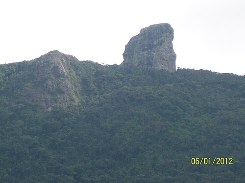
Pedra do Picu
Nature
A 2,151 m peak, symbol of the town and a hiking destination.
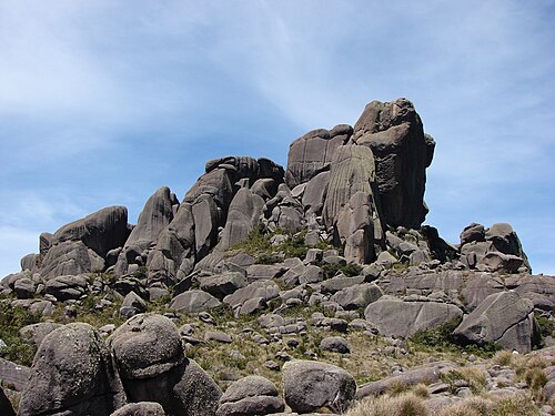
Parque Nacional do Itatiaia
Nature
Itamonte is one of the Minas Gerais entry points to the park, from where you can reach the Pedra do Sino.
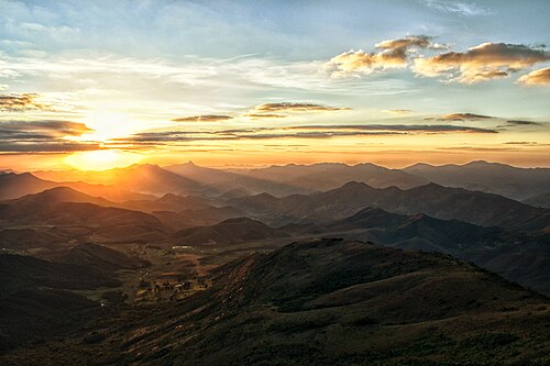
Parque Estadual da Serra do Papagaio
Nature
Protected area covering about a third of the municipality's territory.
Trilhas da Serra Fina
Nature
Mountain traverse well known among trekkers.
Cachoeira da Fragária
Waterfall
One of the municipality's waterfalls.
Cachoeira do Escorrega
Waterfall
A very popular waterfall for swimming.
Cachoeira da Conquista
Waterfall
Another standout waterfall in the region.
Cachoeira da Usina dos Braga
Waterfall
Waterfall linked to an old power plant.
Casa da Cultura Liberato Torino
Museum
The town's cultural center.
Igreja Nossa Senhora da Conceição
Church
The town's mother church.
Heritage
- Folia de Reis do Morro Grande · Group from Itamonte registered by IEPHA in 2017 as part of the Folias de Minas.
Nature
- Parque Nacional do Itatiaia · Federal protected area in the Serra da Mantiqueira.
- Parque Estadual da Serra do Papagaio · Covers about 34% of the municipality's territory.
- APA da Serra da Mantiqueira · Environmental protection area that includes the municipality.
Rivers and waters
- River basin: Grande River (Paraná River basin), Sapucaí River sub-basin 2
- Rivers: Capivari (Picu), Verde
Climate
- Type: Highland tropical (Cwb)
- Winter: Cold and dry, with lows between 0 °C and 10 °C and frost
- Summer: Mild and rainy
Typical food
- Queijo Mantiqueira de Minas · Cheese with a Geographical Indication. The town is known as the Capital of Queijo Mantiqueira de Minas.
Festivals and events
- Festival de Outono do Campo Redondo (Abr) · Festival in the Campo Redondo neighborhood, centered on pinhão (Paraná pine nuts).
- Festival do Queijo Mantiqueira de Minas (Mai) · Brings together artisanal cheeses and local products at the Parque de Eventos José de Oliveira Mota.
- Festa Junina São João do Picu (Jun) · Features square dances, folk dances and food on Praça Padre Francisco Mira, on the third weekend of June.
Fun facts
- The name Itamonte means mountain stone.
- Five of the ten highest peaks in Brazil are in the region, according to a regional guide.
- The town is part of the Caminho Velho of the Estrada Real.
Getting there
- Passa Quatro · about 30 km
- Itajubá · about 70 km
- Pouso Alegre · about 100 km
Notable people from Itamonte
- Diego Romanelli · Greco-Roman wrestler born in Itamonte in 1991. He represented Brazil at the 2011 Pan American Games.
City hall
- Mayor: João Pedro Fonseca (Podemos), term 2025–2028
- Address: Rua Prefeito José Ribeiro Pereira Filho, 206, Centro, Itamonte, MG, CEP 37466-000
- Phone: (35) 3363-2000
- Website: www.itamonte.mg.gov.br
Frequently asked questions
Where is Itamonte?
Itamonte is a municipality in the state of Minas Gerais, Brazil, in the Southern Minas region, 417 km from Belo Horizonte.
What is there to do in Itamonte?
The attractions of Itamonte include Pedra do Picu, Parque Nacional do Itatiaia, Parque Estadual da Serra do Papagaio, Trilhas da Serra Fina, Cachoeira da Fragária, Cachoeira do Escorrega.
What is the population of Itamonte?
Itamonte has about 14,8 thousand inhabitants in an area of 431,8 km².
What is the typical food of Itamonte?
Queijo Mantiqueira de Minas (Cheese with a Geographical Indication. The town is known as the Capital of Queijo Mantiqueira de Minas).
How do you get to Itamonte?
Passa Quatro: about 30 km. Itajubá: about 70 km. Pouso Alegre: about 100 km.
Who was born in Itamonte?
Notable people from Itamonte include Diego Romanelli.
Which tourism region is Itamonte part of?
Itamonte is part of IGR Terras Altas da Mantiqueira, one of the 47 official tourism regions of Minas Gerais, with 9 municipalities.
What are the festivals of Itamonte?
Festival de Outono do Campo Redondo (Abr), Festival do Queijo Mantiqueira de Minas (Mai), Festa Junina São João do Picu (Jun).
What are people from Itamonte called?
People born in Itamonte are called itamontense.
Towns near Itamonte
- Itanhandu · 7 km in a straight line
- São Sebastião do Rio Verde · 13 km in a straight line
- Pouso Alto · 15 km in a straight line
- Passa Quatro · 15 km in a straight line
- Virgínia · 24 km in a straight line
- Alagoa · 27 km in a straight line
- São Lourenço · 27 km in a straight line
- Dom Viçoso · 31 km in a straight line