Santana do Riacho, Minas Gerais
Gateway to the Serra do Cipó · Serra do Espinhaço
Santana do Riacho is one of the municipalities of the Serra do Cipó, in the Serra do Espinhaço range, about 100 km from Belo Horizonte. It is home to the main entrance of the Parque Nacional da Serra do Cipó, with waterfalls, canyons and rocky highland grasslands. In the districts of Serra do Cipó and Lapinha da Serra, nature and adventure tourism is the main focus. The region is part of the Reserva da Biosfera da Serra do Espinhaço.
Santana do Riacho at a glance
- Population: 5,3 thousand
- Area: 677 km²
- Elevation: 750 m
- Distance from Belo Horizonte: about 100 km
- Demonym: riachense
- Founded: 1962
- Region: Greater BH and Central
- Tourism region: IGR Serra do Cipó
- Area code: 31
- IBGE code: 3159001
Santana do Riacho is part of the tourism region IGR Serra do Cipó.
History
Settlement began in the 18th century. In 1744, ownership of Fazenda Riacho Fundo was granted to sergeant major Antônio Ferreira de Aguiar e Sá, and in 1759 the local chapel was inaugurated.
The district went through several changes over time. It was abolished in 1836 and re-created in 1844. In 1866 it was attached to Conceição do Mato Dentro, in 1901 to Santa Luzia do Rio das Velhas and, in 1938, to Jaboticatubas. In 1923 it was renamed Riacho Fundo.
Santana do Riacho was made a municipality by state law no. 2,764 of December 30, 1962, and officially established on March 1, 1963.
The Parque Nacional da Serra do Cipó was created in 1984. In October 2012 the park suffered the largest fire in its history, which burned about 6,200 hectares.
Timeline
- 1744 · Ownership of Fazenda Riacho Fundo granted to Antônio Ferreira de Aguiar e Sá
- 1759 · Inauguration of the local chapel
- 1844 · District re-created
- 1923 · District renamed Riacho Fundo
- 1938 · District becomes part of Jaboticatubas
- 1962 · Elevated to municipality
- 1963 · Municipality officially established
- 1984 · Creation of the Parque Nacional da Serra do Cipó
- 2003 · Cardeal Mota district renamed Serra do Cipó
- 2012 · Largest fire in the park's history
Things to do in Santana do Riacho: attractions
Parque Nacional da Serra do Cipó
Nature · Main entrance in Santana do Riacho, MG-010
A protected area created in 1984, covering about 33,800 hectares, with waterfalls, canyons and rocky highland grasslands. It is shared by four municipalities.
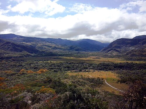
Lapinha da Serra
Village · District of Santana do Riacho
A village with waterfalls and adventure sports, connected to the town by a road with a dirt section.
Cachoeira da Farofa
Waterfall · Parque Nacional da Serra do Cipó
A waterfall over 70 meters high inside the park, reached by a trail of about 2 hours.
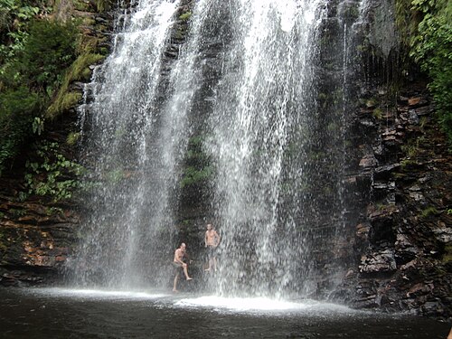
Cânion das Bandeirinhas
Nature · Parque Nacional da Serra do Cipó
Rock walls along a long trail of about 12 km.
Cachoeira Grande
Waterfall · Parque Nacional da Serra do Cipó
A waterfall about 10 meters high and 60 meters wide on the Rio Cipó.
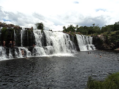
Cachoeira do Gavião
Waterfall · Parque Nacional da Serra do Cipó
Rapids and falls well suited to adventure sports.
Véu da Noiva
Waterfall · Parque Nacional da Serra do Cipó
A waterfall with a natural pool, one of the most visited in the region.
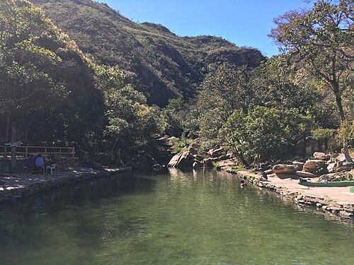
Pico do Breu
Viewpoint · Serra do Espinhaço
The highest point in the municipality, at 1,687 m, in the Serra do Espinhaço.
Heritage
- Parque Nacional da Serra do Cipó · Created by Decree no. 90,223 of 09/25/1984
- Reserva da Biosfera da Serra do Espinhaço · Recognized by UNESCO, it covers the municipality's territory
Nature
- Parque Nacional da Serra do Cipó · A protected area with waterfalls, canyons and rocky highland grasslands
- APA da Pedreira · An environmental protection area in the municipality
- Pico do Breu · The highest point, at 1,687 m
Rivers and waters
- River basin: Rio São Francisco (Rio das Velhas sub-basin)
- Rivers: Rio Cipó, Rio Parauninha
Climate
- Type: Mild mesothermal tropical (Cwb)
- Winter: Dry and mild; July is the coldest month, averaging 18.7 °C
- Summer: Hot and rainy; February is the hottest, averaging 23.8 °C
- Best time to visit: April to September, the dry season
Typical food
- Minas cuisine · Restaurants in the village serve traditional Minas Gerais food, such as Casa Mineira
Chefs from Santana do Riacho
- Sandra Antunes · Bistrô Lapinha. In Lapinha da Serra, Serra do Cipó.
- Marina Leite e Guilherme Azevedo · Casulo. In Lapinha da Serra. The 2015 gelato shop now also serves risottos.
Flavors of Minas: typical dishes and chefs
Festivals and events
- Carnival · In February or March
- Feast of Santa Ana (Jul) · During the week of July 26
- June festivals (Jun) · In June and July (traditional June festivals)
- Feast of Santa Terezinha (Oct) · A religious festival in October
Fun facts
- The Serra do Cipó district was called Cardeal Mota until 2003.
- The municipality was once called Riacho Fundo, from 1923 to 1962.
- The Parque Nacional da Serra do Cipó is shared by Santana do Riacho, Jaboticatubas, Morro do Pilar and Itambé do Mato Dentro.
- Roberto Burle Marx called the Serra do Cipó the Garden of Brazil.
Getting there
- Belo Horizonte · About 100 km via MG-010, around 2 hours
Districts
Notable people from Santana do Riacho
- Antônio Ferreira de Aguiar e Sá · Sergeant major who in 1744 received possession of Fazenda Riacho Fundo, the start of the region's settlement and exploitation.
People born in Santana do Riacho
- Lacy Carlos Dias · Político do Brasil · b. 1954
City hall
- Mayor: Fernando Ribeiro Burgarelli (Fernando da Farmácia) (Republicanos), term 2025–2028
- Address: Rua Alfredo Domingos de Melo, 44, Santana do Riacho, MG, CEP 35845-000
- Phone: (31) 3718-6104
- Website: www.santanadoriacho.mg.gov.br
Frequently asked questions
Where is Santana do Riacho?
Santana do Riacho is a municipality in the state of Minas Gerais, Brazil, in the Greater BH and Central region, cerca de 100 km from Belo Horizonte.
What is there to do in Santana do Riacho?
The attractions of Santana do Riacho include Parque Nacional da Serra do Cipó, Lapinha da Serra, Cachoeira da Farofa, Cânion das Bandeirinhas, Cachoeira Grande, Cachoeira do Gavião.
What is the population of Santana do Riacho?
Santana do Riacho has about 5,3 thousand inhabitants in an area of 677 km².
What is the typical food of Santana do Riacho?
Comida mineira (Restaurants in the village serve traditional Minas Gerais food, such as Casa Mineira).
When is the best time to visit Santana do Riacho?
April to September, the dry season. The climate is mild mesothermal tropical (cwb).
How do you get to Santana do Riacho?
Belo Horizonte: About 100 km via MG-010, around 2 hours.
Who was born in Santana do Riacho?
Notable people from Santana do Riacho include Antônio Ferreira de Aguiar e Sá, Lacy Carlos Dias (politician of brazil).
Which tourism region is Santana do Riacho part of?
Santana do Riacho is part of IGR Serra do Cipó, one of the 47 official tourism regions of Minas Gerais, with 9 municipalities.
What are the festivals of Santana do Riacho?
Carnaval, Festa de Santa Ana (Jul), Festas juninas (Jun), Festa de Santa Terezinha (Oct).
What are people from Santana do Riacho called?
People born in Santana do Riacho are called riachense.
Towns near Santana do Riacho
- Baldim · 28 km in a straight line
- Jequitibá · 33 km in a straight line
- Conceição do Mato Dentro · 35 km in a straight line
- Morro do Pilar · 37 km in a straight line
- Jaboticatubas · 38 km in a straight line
- Santana de Pirapama · 38 km in a straight line
- Congonhas do Norte · 41 km in a straight line
- Funilândia · 42 km in a straight line